-
Find the spot on the map and get the coordinates.
The first number is the latitude which specifies the north-south position.
The second number is the longitude which specifies the east-west position.-
http://maps.google.com/
Click the spot and you will find the latitude and longitude in the URL as well as in a popup notification dialog:
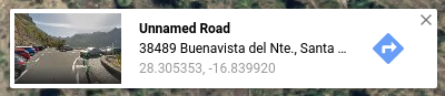
https://www.google.com/maps/@28.3052659,-16.840323,359m/data=!3m1!1e3 -
https://www.openstreetmap.org/
Double-click the spot - the map will center on that area, and then you have the right coordinates in the URL:
https://www.openstreetmap.org/#map=19/28.30539/-16.83983
-
http://maps.google.com/
-
Tag your photo:
You need to set the following tags:-
GPSLatitudeReftoNif north/positive, orSif south/negative. GPSLatitude-
GPSLongitudeReftoWif west/negative, orEif east/positive. GPSLongitude
exiftool -overwrite_original -GPSLatitudeRef=N -GPSLatitude=28.30539 -GPSLongitudeRef=W -GPSLongitude=-16.83983 photo.jpg -
4 Likes
Or use the map module in darktable:
https://www.darktable.org/usermanual/en/map_chapter.html
1 Like
I am trying to add GPS tags from a gpx file.
I am using Ubuntu. This works:
exiftool -geotag "/media/macgyver/4GB/krypterat/decrypt/*.gpx" /media/macgyver/4GB/krypterat/decrypt
This doesn’t work:
exiftool -geotag "*.gpx" dir
This does work:
exiftool -geotag "*.gpx" /media/macgyver/4GB/krypterat/decrypt

How come I can’t use dir to simplify things?

Seems the easiest thing is to use exiftool -geotag "*.gpx" *CR2
Problem solved.
Why not use geosetter? It uses EXIFtool internally but makes life easier.
Hermann-Josef
Isn’t that windows only?
Yes, it is Windows only.
Didn’t know about it. I normally use darktable when adding GPS tags, but I wanted to add the tags into the raw files instead of just the XMP files if I ever would need to change software.
Seems also like the raw files from 1Ds, TIF files, don’t have a GPS tag to change at all.
Note that darktable stores the XMP data for geolocation in a standard XMP tag, so other applications that understand XMP should be able to read it
I use digikam for that. It has built-in map and ability to copy and paste coordinates.
I also use Reverse Geocodding there which will convert GPS coordinates into location names and add them as tags