I am geo-tagging images based on gpx-tracks.
For double-checking I would like to simply copy the coordinates of a geotagged image to the clipboard such that I can go to the location in google maps (or another service).
This does not seem to be possible through the GUI, is it?
You can view the photo location in the maps module, by clicking the word “map” in the upper right of the application or by hitting the M key in lighttable.
Thanks, I enabled it, but the copy GPS data button does not modify my clipboard. (I must admit I’m still running Windows on my computer for photo editing)
Another cumbersome feature (?) is that one cannot select an image in the map mode.
I can in lighttable, but there I don’t have the map feature which would help me assess if the tagged location is credible.
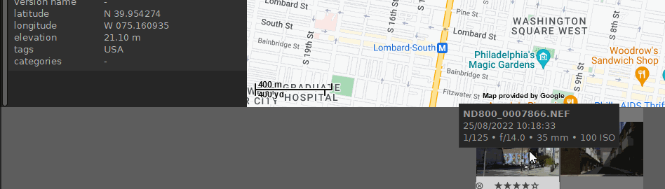
See for yourself. I have always been wondering if this is a bug or a feature:
That’s right. It’s only for “internal” copying in darktable. But perhaps you can improve the scripts for your needs. There is for example the “open in Gnome-Maps” button, perhaps you can change it to “open in Google-Maps”. or you can find a way how to fill the data into the Windows clipboard.