Hi all!
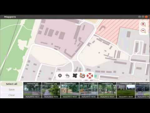
I’m here to announce a very old application, which I’ve actually written 8 years ago, but that I’ve been lately trying to bring back to life: Mappero Geotagger. It’s a simple tool which accept photos (via drag & drop), and allows you to see them on a map, change/set their position, or automatically find the right position by correlating the timestamps with a GPX or KML GPS track.
I guess it’s easier explained with a video (very old, but all the functions you see in the video are still there, and I lack time at the moment to prepare a better video):
I’ve prepared a new website so that search engines will have something to point to, and it’s one more attempt to see if I can sell some of my open source software. There is some twist, however, since the website payment page also informs the user that the application can be obtained completely free of charge by writing me an e-mail — but I’m still hopeful that someone will still buy it.
Ubuntu (and maybe Debian) users are somehow in a privileged position as they can enjoy free daily builds just by adding this PPA, but of course that also comes with all the risks of getting a development version of an application. I’m of course trying hard not to break stuff, but everything can happen. ![]()
Please feel welcome to use this thread for feedback (both for the application, and for the selling model).
Ciao,
Alberto
